A Drive Around The Island
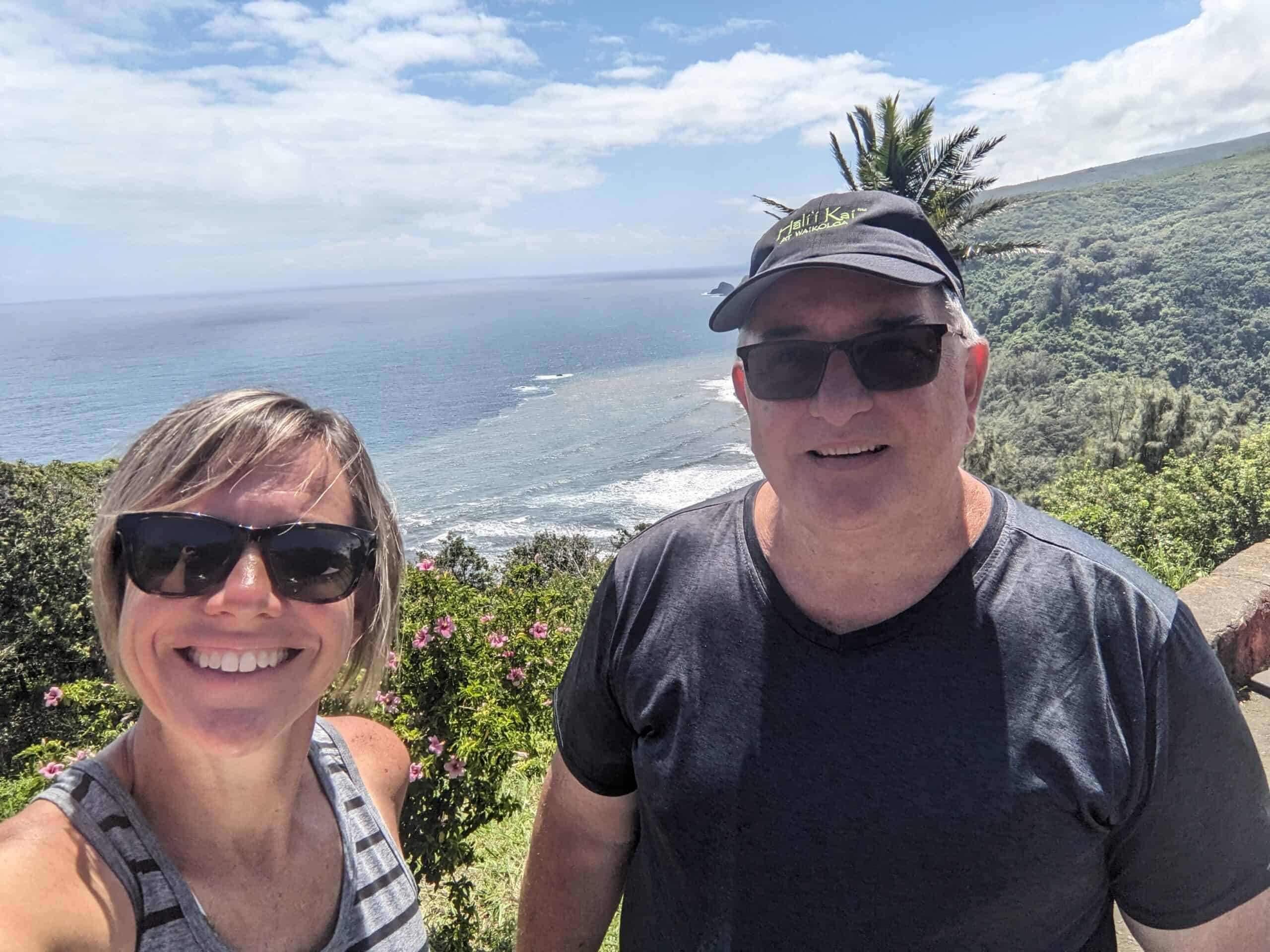
Our flight to the Big Island of Hawaii was at 6:00a.m. so it was another early morning for us, but in reality I was up before my alarm anyway. Perhaps it was part of the anticipation of a new adventure, or perhaps it was my body thinking it was still in the central time zone. Our flight left right on time and before we knew it we were watching the sunrise over Hawaii from the air and at 7:00a.m. we were on the Big Island. We hadn’t eaten breakfast before we left so the first order of business was finding a place to eat. I used my trip advisor app on my phone and found a nearby restaurant called Ken’s House of Pancakes. It sounded like the perfect place to grab breakfast! It was only about a mile from the airport so we were sitting in a booth and ordering breakfast in no time. While we waited for our food we scanned all the brochures we grabbed at the airport for excursions/points of interest for the island. We quickly decided that we would like to do a helicopter tour of the volcano. We called three different tour companies and decided on the “Doors Off” extreme helicopter tour. We made reservations for Wednesday morning at 8:30 . . . Wednesday would be another early day.
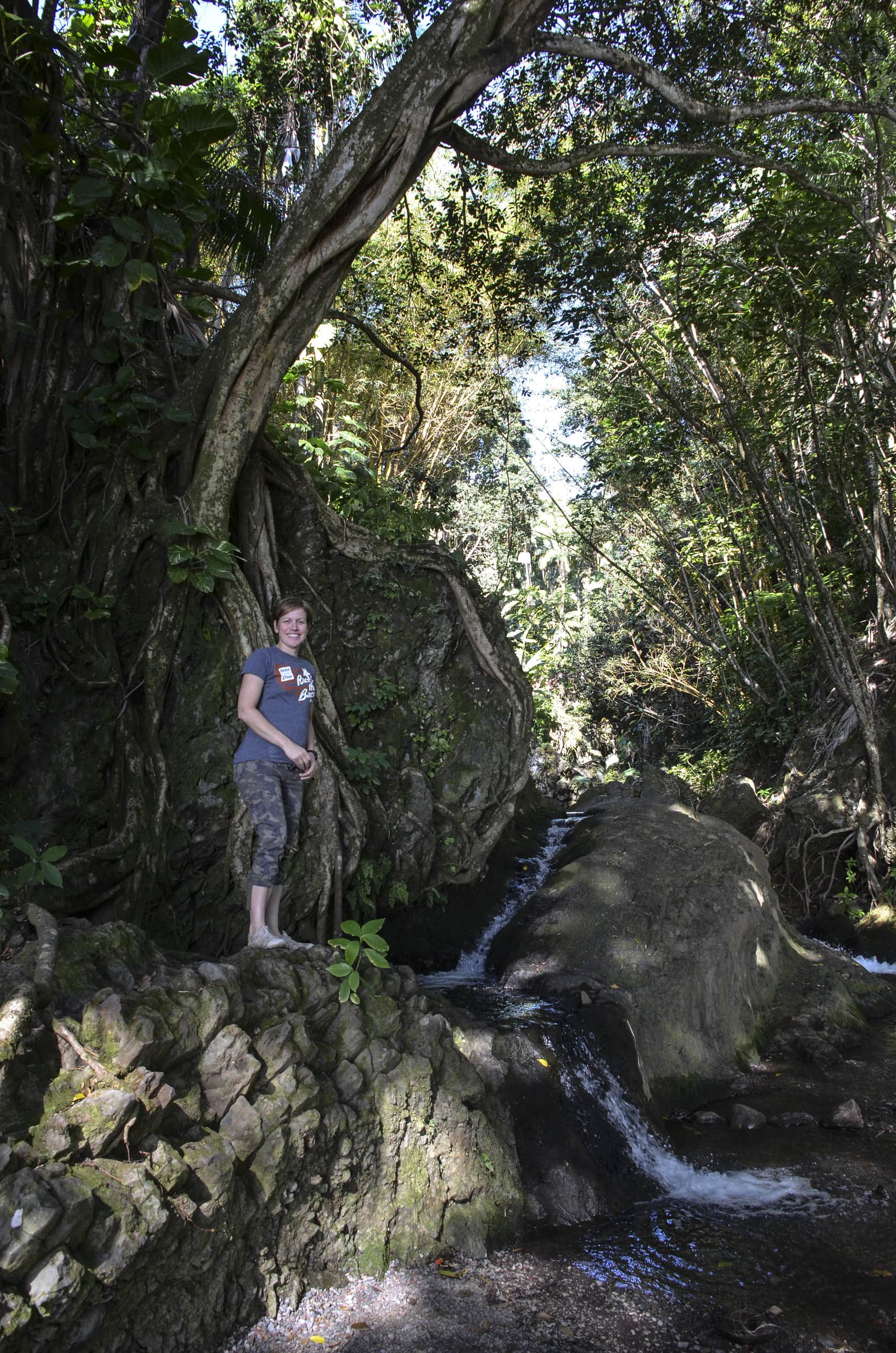 With a plan set for Wednesday morning and our bellies full of eggs and pancakes, we set off to see the sights. The first stop we picked out on the map was Akaka Falls. On the way I pulled up my geocaching app to see if there were any on the way. I found one that sounded interesting near a bay with a scenic view. Right up my ally! So we headed towards it and took us on the Onomea Scenic Drive route. We found the trail head and started the hike down the hill towards the bay and geocache. As it goes with geocaches, sometimes you find yourself on the wrong side of a river, creek, or stream. We were at the bottom of the trail and the GPS still said the geocache was 200 feet pointing to the other side of the beach that was separated by shallow water. The water was shallow enough for me to traverse with my sandals, but too deep for Tom to go with his tennis shoes. Tom gladly sat and relaxed while I went the extra couple hundred feet in search of the cache. I found the group of trees where I believed the cache was hidden, but after some searching and clue reading I determined that the cache was up to high for me to see and it probably required some climbing. Since I was by myself, I opted to turn around and go back and take the DNF.
After getting back to the car I looked at the map and decided we should go check out Rainbow Falls before going to Akaka Falls. Unfortunately this required us to back track 10 or so miles. We probably should have went there first, but oh well. I wasn’t overly impressed with Rainbow Falls, but we overheard a nearby tour guide say that it has been dry of late so the falls were not as big as they usually are. He showed us some pictures on his cell phone of what it looks like normally and what it looks like after a big rain. The falls today were nowhere even close. Time to move on to Akaka Falls.
 At Akaka Falls there was a nice trail loop to the falls. The falls were impressive in height, but once again not as “full” as I think they normally would be. After the hike I was able to score my first cache in Hawaii. Not more than 100 feet from where I parked the car was a nice guardrail cache. Easy, but I’ll take it!
Once again back in the car it was time to figure out what to do next. We decided to let geocaching take us to our next destination. A little over a mile from Akaka Falls was a cache that looked to be along the coast. We decided to go for it. After driving back and forth along the highway a couple of time we finally spotted the tiny little pull-off where it looked like the trail started. The GPS said it was a little more than a quarter mile away. We started hiking down the trail, which actually was big enough (and probably meant for cars to drive on). I commented that perhaps we should have driven the car down, but the further we went along the rougher it got so it was probably best we left the car along side the road. About halfway down to cache Tom asked me if I had the car keys. I did not and thought he was joking, but he said he was serious that he didn’t have the keys. He then asked me if I locked the car, and I said yes I had hit the lock on the door. Our rental car is a Nissan Altima that has a push-to-start ignition (meaning the keys don’t actually have to be inserted anywhere to start the car, they just have to be in the car). So for some reason the keys were still in the car. Well there was nothing much we could do about it until we knew for sure if the car was really locked, so we continued on to the cache. It was a beautiful remote location, but there was no cache to be found. I suppose I should have read the logs before committing to do this cache. It seems like it has been missing for awhile. Although we enjoyed the scenery and hiking around, I couldn’t believe we had locked our keys in the car for a cache that wasn’t even there. After exploring the area for a bit it was time to hike back up the hill and deal with our locked keys problem. I got back to the car and looked through the window and saw the keys sitting in the cup holder. I tried the handle anyway, and wouldn’t you know the car wasn’t locked! Yay that we didn’t have to wait for somebody to help us get the car unlocked and yay that nobody stole our stuff or our car. We were very lucky and learned a valuable lesson. From then on, we were always sure we had the keys.
After that fun adventure we had worked up an appetite and went to find lunch in the nearby town. Tom had a mahi mahi wrap and I had a mahi mahi curry meal. We both enjoyed our food immensely. It was about 2:00 when we were done with lunch. Check-in at our lodging was until 3:00, but even though it would take us over an hour to get there, we made the decision to go the long way around the island. I didn’t have any battery left in my cell phone and the car didn’t have a USB outlet for charging so we were out of luck to try any more geocaches, but after my two DNF’s I was kind of feeling discouraged anyway. I was just happy to have the one that put me on the map. The drive was pretty uneventful. The scenery was nice and it was good to get a feel for the whole island. We made a couple of stops along the way and even saw some whale activity in the distance at one of the beach parks we stopped at. We were making good progress until we got close to Kona, then the traffic was backed up a loooong way. I didn’t look at the time, but I bet we creped along for an hour. There were no accidents, it was just the flow of people and the stop and go lights that caused the back-up. Soon it was getting dark and I started thinking “whose idea was it to drive around the island.” I was especially thinking this when it had become dark and I saw a sign that said we had 73 miles to go and the road was super curvy. Of course it had been my idea, but what are you going to do. I was just happy that the entire 73 miles was not the curvy roads and was super thankful when we arrived to our lodging at the Kilauea Military Camp. It was about 8:30p.m. when we checked in and the lady at the front desk asked if we had seen the red glow of the volcano as we had come up. We had, and she said it was a super clear night and we should go check it out. The viewing spot is only a mile from where we are staying so we headed straight to it. The sky was lit up with a million stars and the red glowing steam vent of the Kilauea caldera (crater) was an amazing view. The steam is red as it is a reflection from the lave lake below the surface. During the day you just see the steam, but at night you can see the red glow. Amazing! So glad we came to see it.
After a long day of adventure and driving we grabbed a quick bite to eat at the bowling alley on the camp and headed to bed as once again we had another early morning in store for our helicopter adventure!